
Level surveys
Spot heights, floor levels and falls measured to OS datum or a site datum, for drainage design, slab and screed checks, flood risk assessments and site grading.
What a level survey is for
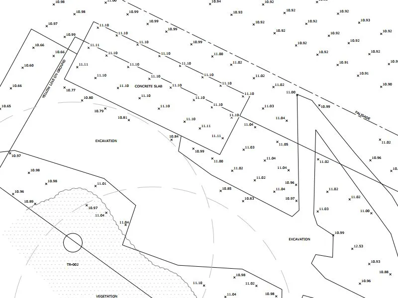
A level survey records the height of points across a site or floor relative to a datum. It answers practical questions quickly: will this drain fall to the outfall, is the screed within tolerance, where does the finished floor level need to be, and how much ground needs to move.
Typical uses
- Drainage design. Existing levels and covers so engineers can design falls that work.
- Slab and screed checks. Level grids that show whether a floor is flat and level enough for the finish going on it.
- Floor and threshold levels. For extensions, flood risk assessments and planning drawings.
- Site grading and earthworks. Existing levels to calculate cut and fill.
How we work
We survey with total stations, digital levels and GNSS, tied to Ordnance Survey datum or a site benchmark. Results come back as CAD and PDF drawings, with a level schedule if you need one. If you also need boundaries, buildings and features, a topographical survey captures levels and everything else in one visit.
How it works
Scope and fixed quote
We agree the areas, the datum and the outputs you need, such as plans, sections or a level schedule, then send a fixed price.
Survey
Our surveyors record levels with total stations, digital levels or GNSS, depending on the accuracy and the site.
Drawings issued
You receive clear CAD and PDF drawings, ready to use. Typical lead-in is 5 to 10 days.
Recent projects
See all projectsWhat clients say
Read our reviews on Google★★★★★
I was impressed by THS Concepts topographical survey services' professionalism and accuracy. They were efficient and reasonably priced. I highly recommend them.
★★★★★
We recently approached THS Concepts to carry out a level survey of the screed to the ground floor of a large residential property we were Project Managing. The property was undergoing extensions and refurbishment work. We had a tight timescale to receive the information, and THS Concepts delivered quickly and efficiently to meet our deadline. This is the second time we have used them and would highly recommend.
★★★★★
We have used THS Concepts for multiple surveys from topographic to drone photogrametry, they are professional and prompt and deliver exactly what is requested. Highly recommended.
Level surveys: common questions
What is a level survey?
A level survey measures the height of points on the ground or a floor relative to a datum, usually Ordnance Survey datum or a site benchmark. It is used to design drainage, check that slabs and screeds are within tolerance, set floor levels and plan site grading.
What is the difference between a level survey and a topographical survey?
A level survey records heights only, usually at a grid or set points. A topographical survey records levels as well as every feature on the site, such as boundaries, buildings, trees and drainage. If you only need heights, a level survey is quicker and cheaper.
How much does a level survey cost?
It depends on the size of the area and the detail needed. We prefer to give a fixed price, though we can work to a day rate if that suits the job better.
How quickly can you return the levels?
Typical lead-in is 5 to 10 days, and level information can be issued as quickly as 24 hours after the survey.
Related services
- Setting out
Gridlines, foundations, piles and roads set out on site.
- Measured building surveys
Floor plans, elevations and sections of existing buildings.
Tell us about your site
Send a location, a rough brief and your deadline. We reply with a fixed quote within 24 hours.