
Street scene elevation surveys
Accurate street scene elevations showing your building alongside its neighbours, with ridge, eaves and ground levels, so planners can see exactly how a proposal fits the street.
What a street scene elevation shows
A street scene elevation draws the front of your building together with the buildings either side, as they are seen from the street. Every building carries its ridge, eaves and parapet levels, and the ground level is shown along the frontage, so the drawing shows how the street steps and how heights relate from one building to the next.
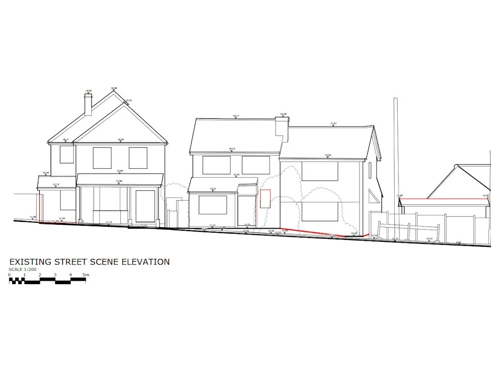
Full detail or outline for the neighbours
Your own building is always drawn in full: openings, porches, chimneys, materials and levels. For the neighbouring buildings you can choose full detail, or an outline with the key levels where the planners only need to see massing and roof lines. Tell us what your architect needs and we will suggest how far each side to go.
Surveyed from the street
Street scenes are captured from the public footpath with a 3D laser scanner, so we do not need access to the neighbours’ properties. Where upper storeys or roofs are hidden from the ground, we add capture with a survey drone. The same data gives you elevations of your own building and an existing roof plan if you need them.
Built for planning applications
Street scenes are one of the most common drawings asked for in planning applications, particularly for extensions, new houses and roof alterations, where the planners want to see the proposal against its neighbours. They are drawn to the scale you need and supplied as DWG and PDF, ready for your architect to draw the proposal over. Before you apply, it is worth checking the site in our free planning constraints checker for conservation areas, listed buildings and Article 4 directions.
How it works
Scope
Agree how far the street scene runs each side, and whether neighbours are drawn in full detail or as an outline.
Survey
We capture the frontage from the street with a 3D laser scanner, adding survey drone capture for roofs and upper storeys where needed.
Draft and check
The elevation is drafted from the point cloud, with levels on each building, and checked before issue.
Who we work with
Architects
Existing street scenes to draw proposals against for planning.
Planning consultants
Clear evidence of ridge heights and building lines along the street.
Developers and homeowners
The accurate existing drawing a planning application needs.
Where we work
From our base in Leigh-on-Sea, Essex, we carry out street scene elevations across London, Essex, Kent, Hertfordshire and the rest of the UK. Local pages:
What clients say
Read our reviews on Google★★★★★
Having worked with THS for several years now, each project is treated with high professionalism every time. We would highly recommend their team.
★★★★★
I was impressed by THS Concepts topographical survey services' professionalism and accuracy. They were efficient and reasonably priced. I highly recommend them.
★★★★★
We recently approached THS Concepts to carry out a level survey of the screed to the ground floor of a large residential property we were Project Managing. The property was undergoing extensions and refurbishment work. We had a tight timescale to receive the information, and THS Concepts delivered quickly and efficiently to meet our deadline. This is the second time we have used them and would highly recommend.
Street scene elevations: common questions
What is a street scene elevation?
A drawing of the front of your building and the buildings either side, as seen from the street, with heights and levels. Planners use it to judge how an extension, new house or alteration will sit next to its neighbours.
How many neighbouring buildings do you include?
As many as your architect or the planners need. Neighbours can be drawn in full detail, or as an outline with ridge and eaves levels where less detail is required, which keeps the cost down.
Do you need access to the neighbouring properties?
No. Street scenes are captured from the public footpath with a 3D laser scanner, with a survey drone where upper storeys and roofs cannot be seen from the ground.
What scale and format do you supply?
To suit your project, often 1:100 or 1:200, as DWG and PDF. The same survey can also be turned into a BIM model if required.
Guides
Related services
- Drone surveys
Aerial LiDAR, mapping and roof inspections.
- Topographical surveys
Site levels, features and boundaries for planning and design.
Tell us about your site
Send a location, a rough brief and your deadline. We reply with a fixed quote within 24 hours.