Leigh-on-Sea, Essex
St Christopher's School, Leigh-on-Sea
Planning application surveys, 3D laser scanning

Services
The existing site information your planning drawings depend on: levels, boundaries, trees, access and neighbouring buildings, tied to the OS grid and drawn ready for your architect to design over.
A planning application lives or dies on the accuracy of its existing information. Site plans, sections and street elevations all start from the topographical survey, and errors in levels or boundaries tend to surface at the worst time: during consultation, at appeal or on site.
For planning we record spot levels and contours, building positions, fence lines, trees, hard and soft landscaping, access points and drainage. Where the scheme affects neighbours, we also pick up adjoining buildings, window positions and ridge and eaves heights, so overlooking, daylight and massing can be tested properly.
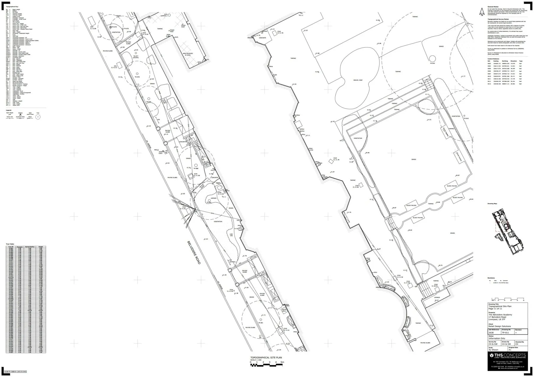
Every drawing is tied to the Ordnance Survey grid and layered cleanly in CAD. Your architect can drop it straight into the model, and the same survey control can be used later for setting out.
Mark up the site and anything beyond it the planning drawings need, such as neighbouring facades or the full road width.
We capture the site with GNSS and total stations in a single visit for most residential and small commercial sites.
Layered DWG and PDF, at the right coordinates and levels, ready for site plans, sections and street elevations.
A base drawing for site plans, sections and street elevations.
Accurate existing information to support the application and any appeal.
Constraints identified before design fees are committed.
Leigh-on-Sea, Essex
Planning application surveys, 3D laser scanning
★★★★★
I was impressed by THS Concepts topographical survey services' professionalism and accuracy. They were efficient and reasonably priced. I highly recommend them.
★★★★★
We recently approached THS Concepts to carry out a level survey of the screed to the ground floor of a large residential property we were Project Managing. The property was undergoing extensions and refurbishment work. We had a tight timescale to receive the information, and THS Concepts delivered quickly and efficiently to meet our deadline. This is the second time we have used them and would highly recommend.
★★★★★
Having worked with THS for several years now, each project is treated with high professionalism every time. We would highly recommend their team.
It is not always a formal validation requirement, but planning authorities expect site plans and sections drawn to existing levels, and most schemes beyond a minor extension need a survey to produce them accurately.
Usually yes. Window positions, ridge and eaves heights on adjoining buildings let your architect test overlooking, daylight and massing. Tell us at quote stage how far beyond the boundary to go.
We record tree positions, trunk girths, canopy spreads and heights. If the authority needs an arboricultural report, your arboriculturist can work directly from our drawing.
Floor plans, elevations and sections of existing buildings.
Aerial LiDAR, mapping and roof inspections.
Send a location, a rough brief and your deadline. We reply with a fixed quote within 24 hours.