
Drone LiDAR and aerial mapping surveys
Aerial LiDAR or photogrammetry, captured by drone and tied to the OS grid. Ideal for large sites, roofs and upper elevations that are slow or unsafe to survey from the ground.
Why survey from the air
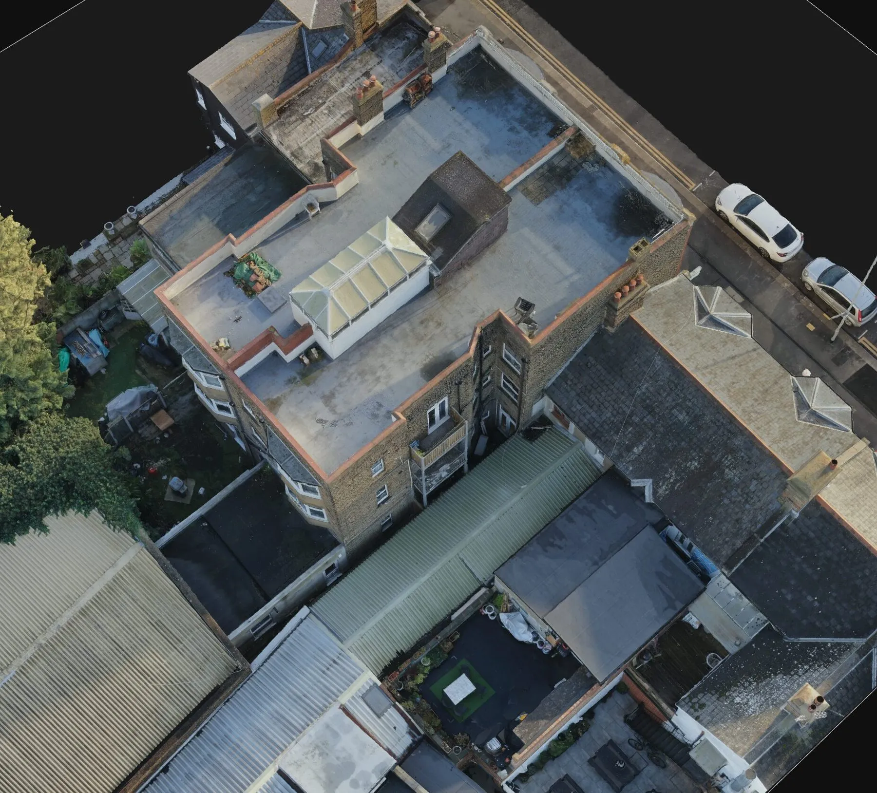
Large sites, roofs and upper elevations take time to survey from the ground, and some areas are simply unsafe to walk. A drone captures them in a fraction of the time, producing a dense, coloured point cloud and orthophoto of the whole area.
Tied to the ground
Every flight is controlled by ground targets fixed with GNSS and tied to the Ordnance Survey grid, so drone data lines up with our ground surveys and laser scans. Hard detail that drones miss, such as drainage covers, kerbs and features under trees, is picked up on the ground and merged into the same drawing.
Typical uses
Terrain models for early design on large sites, roof and facade capture for refurbishments, progress records on active sites, and stockpile and earthworks volumes.
How it works
Plan the flight
We check airspace and permissions, agree the area and accuracy, and set ground control.
Fly and capture
Our CAA-qualified pilots fly the site on planned lines, capturing LiDAR or overlapping photography.
Process and deliver
Data is processed, checked against ground control and delivered as point clouds, models and drawings.
Who we work with
Civil engineers and developers
Terrain and surface models of large sites for early design and earthworks.
Architects
Roofs and upper elevations of buildings that cannot be seen from the ground.
Contractors
Progress records and volumes across active sites.
Recent projects
See all projectsWhat clients say
Read our reviews on Google★★★★★
I was impressed by THS Concepts topographical survey services' professionalism and accuracy. They were efficient and reasonably priced. I highly recommend them.
★★★★★
We recently approached THS Concepts to carry out a level survey of the screed to the ground floor of a large residential property we were Project Managing. The property was undergoing extensions and refurbishment work. We had a tight timescale to receive the information, and THS Concepts delivered quickly and efficiently to meet our deadline. This is the second time we have used them and would highly recommend.
★★★★★
We have used THS Concepts for multiple surveys from topographic to drone photogrametry, they are professional and prompt and deliver exactly what is requested. Highly recommended.
Drone LiDAR surveys: common questions
Should I choose LiDAR or photogrammetry?
We offer both. LiDAR measures through gaps in vegetation and records ground under trees more reliably. Photogrammetry gives high-detail coloured models of open sites, roofs and buildings. We recommend the method that suits the site.
How accurate is drone survey data?
Accuracy depends on the sensor, flying height and ground control. Data is checked against ground control points tied to the OS grid, and we combine it with ground survey where design accuracy is critical.
Can drone data replace a ground topographical survey?
For large open areas it can cover most of the site, but hard detail such as drainage covers, kerbs and features under trees is still best picked up on the ground. Most of our drone work is combined with a topographical survey.
Related services
- Topographical surveys
Site levels, features and boundaries for planning and design.
- 3D laser scanning
Point clouds and BIM models of buildings, plant and structures.
Tell us about your site
Send a location, a rough brief and your deadline. We reply with a fixed quote within 24 hours.