Foulness Island, Essex
Foulness Island drainage scheme
Hydrographic surveys, Topographical surveys, Drone surveys

Services
Water depths and bed levels for lakes, rivers, ponds, reservoirs and marinas, surveyed with a remote-controlled boat. Safer than wading or crewed boats, and delivered as CAD drawings and terrain models.
Full member of The Survey Association, the UK trade body for survey companies.
Fixed price, confirmed timescales, no surprises on the invoice.
Over 2,000 surveys, from home extensions to nuclear power stations.
£1m professional indemnity and £5m public liability cover.
A hydrographic or bathymetric survey measures the depth of water and the shape of the bed beneath it. Engineers, landowners and contractors use the results to plan dredging, design structures in or beside water, and check work after construction.
Our shallow-draft boat is controlled from the bank, so nobody has to wade into the water or work from a crewed boat. One person can launch it without a crane, and it is manoeuvrable enough for tight, shallow or enclosed spaces such as weirs, locks and water treatment plants, where conventional methods are no longer appropriate.
Most projects need the banks as well as the bed. We combine hydrographic work with a topographical survey of the surrounding land, so you get a single drawing package to design from.
Tell us the water body, the area to survey and what you need the data for. We reply with a fixed price.
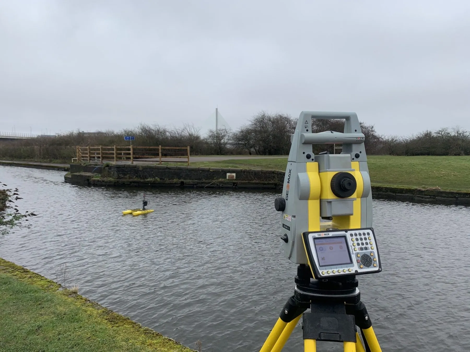
Our surveyors launch the boat and record the bed using sonar, positioned by GNSS or a total station tracking a 360-degree prism.
You receive DWG drawings, a DTM and PDFs. Outline results can often be ready within a few hours of the survey.
Bed levels and depths for dredging, lock, pier and outfall design.
Dredge planning and post-dredge checks for marinas, lakes and ponds.
Pre- and post-construction surveys for new lakes, wetlands and water infrastructure.
Foulness Island, Essex
Hydrographic surveys, Topographical surveys, Drone surveys
★★★★★
We have used THS Concepts for multiple surveys from topographic to drone photogrametry, they are professional and prompt and deliver exactly what is requested. Highly recommended.
★★★★★
I contacted Tom to carry out a Topographic survey, and cannot recommend them enough. Nothing was to much, and I was kept up to date with everything as it happened! Great company to deal with and reasonably priced.
★★★★★
Superb service, quick turnaround and extremely helpful! I wouldn't hesitate to use THS Concepts again if I need to in the future!
A Hydrone remote-controlled survey boat, a twin-hulled catamaran designed for hydrographic work. It is positioned by GNSS or a total station tracking a 360-degree prism, and a sonar records the bed levels.
Dredge surveys in marinas and rivers, lock gate replacement, a new pier in central London, and new lakes and wetlands after construction.
Yes. We often combine hydrographic work with a topographical survey of the banks and surrounding land, all in one drawing package.
Mostly London and the South East, including Kent, Hertfordshire, Sussex, Surrey, Suffolk and Essex, and further afield when projects need it.
Site levels, features and boundaries for planning and design.
Aerial LiDAR, mapping and roof inspections.
Gridlines, foundations, piles and roads set out on site.
Send a location, a rough brief and your deadline. We reply with a fixed quote within 24 hours.