Eastern Esplanade, Southend-on-Sea, Essex
Marine activity centre, Eastern Esplanade
Flood risk level surveys

Services
A focused topographical survey of your site showing the levels of the land, with floor and threshold levels, all to Ordnance Survey datum. Exactly what a flood risk assessment needs, without paying for a full survey.
Sites in flood zones 2 and 3 usually need a flood risk assessment with the planning application. The assessment compares the building’s floor levels with the design flood level, and both have to be on the same datum, so a level survey tied to Ordnance Survey datum is the starting point.
We record existing finished floor levels inside the building, threshold levels at each entrance, external ground levels around the building and across the plot, and levels along access and escape routes. Everything is tied to OSTN15, the current Ordnance Survey height model, so the figures can be compared directly with Environment Agency data.
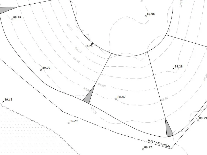
Flood risk level surveys are a stand-alone service and usually a short site visit. If the scheme also needs a full site survey for design, we capture both at once with a topographical survey.
Share the FRA consultant's brief or the planning authority's request, so we capture exactly the levels they need.
Levels are tied to Ordnance Survey datum using GNSS and total stations, with internal floor levels transferred inside.
A drawing and level schedule your FRA consultant can use directly.
Datum-tied levels ready to compare with modelled flood levels.
Existing and proposed floor levels for the application drawings.
The levels needed to get an application in flood zones 2 and 3 validated.
Eastern Esplanade, Southend-on-Sea, Essex
Flood risk level surveys
★★★★★
I was impressed by THS Concepts topographical survey services' professionalism and accuracy. They were efficient and reasonably priced. I highly recommend them.
★★★★★
We recently approached THS Concepts to carry out a level survey of the screed to the ground floor of a large residential property we were Project Managing. The property was undergoing extensions and refurbishment work. We had a tight timescale to receive the information, and THS Concepts delivered quickly and efficiently to meet our deadline. This is the second time we have used them and would highly recommend.
★★★★★
We have used THS Concepts for multiple surveys from topographic to drone photogrametry, they are professional and prompt and deliver exactly what is requested. Highly recommended.
Flood levels are published to Ordnance Survey datum. To show whether floors will sit above the design flood level, the assessment needs existing floor and ground levels on the same datum.
Usually the existing finished floor level, threshold levels at entrances, external ground levels and levels along access routes. Your FRA consultant may ask for more, so send us their brief.
It is a stand-alone, simplified topographical survey that concentrates on land levels rather than every feature on the site. If you also need full site detail for design, we can capture both in one visit with a planning application survey.
Floor plans, elevations and sections of existing buildings.
Bathymetry of rivers, lakes, harbours and marinas.
Send a location, a rough brief and your deadline. We reply with a fixed quote within 24 hours.