
Scan to BIM: Revit models from laser scan data
Revit and IFC models built from registered 3D laser scan data, from basic massing to construction detail. Architectural, structural and MEP, modelled to the level of detail your project needs.
What scan to BIM is
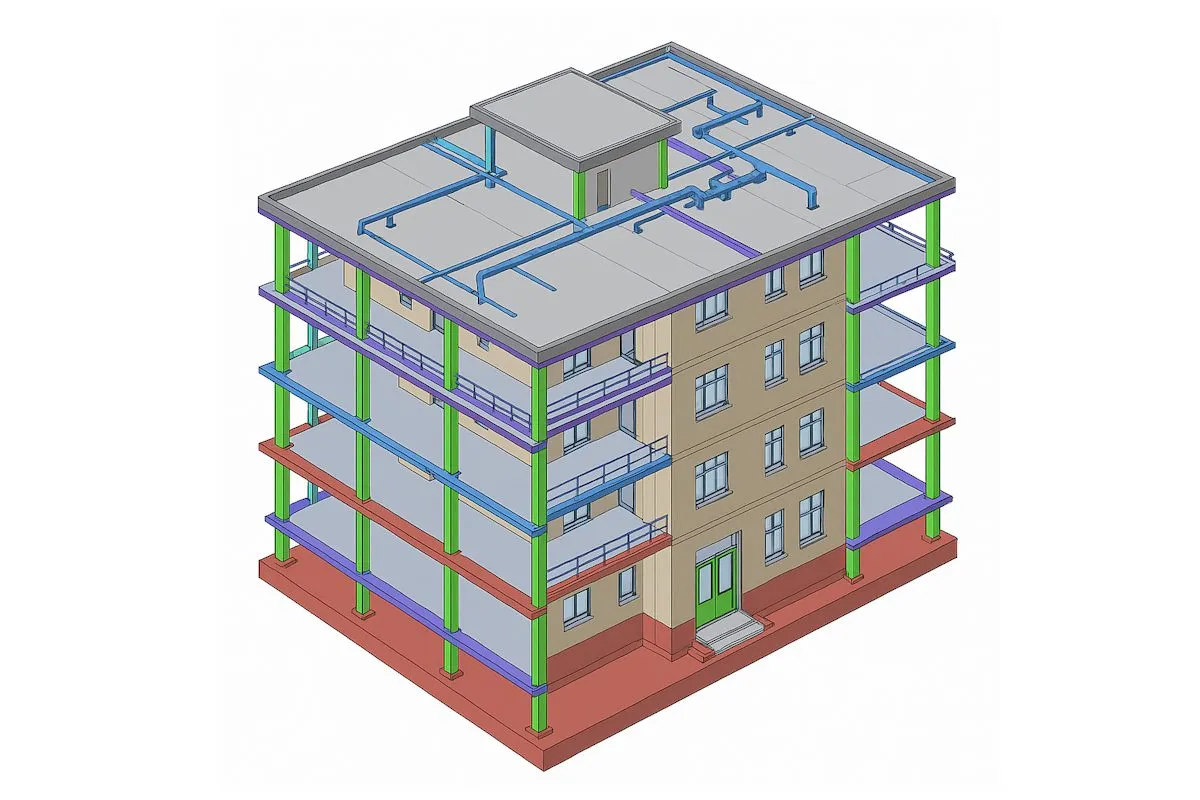
Scan to BIM turns a 3D laser scan of an existing building into a Building Information Model: a 3D digital model that carries geometry and data together. Unlike a set of 2D drawings, the model can hold materials, specifications, asset and maintenance information, and lets the whole team coordinate, check for clashes and make changes in one place.
Modelled from what is really there
Every model starts with a registered point cloud captured by our own surveyors, so the model reflects the building as built, not as originally drawn. Models are checked against the cloud before they leave us, and we walk you through the result before final delivery.
Not just buildings
The same process works for structures and vessels. We scanned and modelled the Silver Sturgeon, a Thames passenger vessel, producing a BIM model from the point cloud.

One scan, many outputs
The same scan can also give you a point cloud for your own team, 2D CAD drawings or a clash check. See 3D laser scanning for every output we produce from a single dataset.
How it works
Briefing
We agree scope, level of detail, the software you use and your timescale.
Scanning
High-resolution 3D laser scans of the interior and exterior, registered into one point cloud, georeferenced on request.
Modelling
Our technicians build the model in Revit, referencing the point cloud throughout.
QA and delivery
The model is checked against the cloud, reviewed with you, adjusted and delivered in your chosen format.
What it costs
Price depends on the size of the building, the level of detail and the disciplines modelled.
| Typical job | Guide price |
|---|---|
| Scan plus architectural BIM model | From £1,000 |
| MEP scan to BIM, federated model | From £2,000 |
Prices exclude VAT.
Who we work with
Architects
An accurate existing model to start design and planning from.
Structural engineers
Data-rich geometry for analysis and retrofit design.
Contractors
Models for setting out, sequencing and clash detection.
Heritage consultants
Detailed records to plan sensitive refurbishment.
Facilities managers
Embedded asset and maintenance data for the building's life.
What clients say
Read our reviews on Google★★★★★
Having worked with THS for several years now, each project is treated with high professionalism every time. We would highly recommend their team.
★★★★★
I was impressed by THS Concepts topographical survey services' professionalism and accuracy. They were efficient and reasonably priced. I highly recommend them.
★★★★★
We recently approached THS Concepts to carry out a level survey of the screed to the ground floor of a large residential property we were Project Managing. The property was undergoing extensions and refurbishment work. We had a tight timescale to receive the information, and THS Concepts delivered quickly and efficiently to meet our deadline. This is the second time we have used them and would highly recommend.
Scan to BIM: common questions
What levels of detail can you model to?
From LOD 100 basic massing to LOD 400 fabrication detail. LOD 200 covers walls, doors, windows and rooflines; LOD 300 adds accurate dimensions and relationships between elements; LOD 400 suits construction and fabrication.
Can you model from existing 2D drawings?
Yes, but for older or altered buildings we strongly recommend a laser scan, because drawings rarely match what is actually there.
Do I need BIM if I only want 2D drawings?
Not necessarily, but one model gives consistent plans, elevations and sections and is ready if you need 3D later. For simple 2D needs, a measured building survey may be enough.
Can you update an existing model?
Yes. We can scan the site and overlay new point cloud data onto your existing model to capture changes.
What software do you use?
Autodesk Revit for modelling, with FARO Scene and CloudCompare for point cloud processing.
Related services
- Measured building surveys
Floor plans, elevations and sections of existing buildings.
Tell us about your site
Send a location, a rough brief and your deadline. We reply with a fixed quote within 24 hours.