
Elevation and section surveys
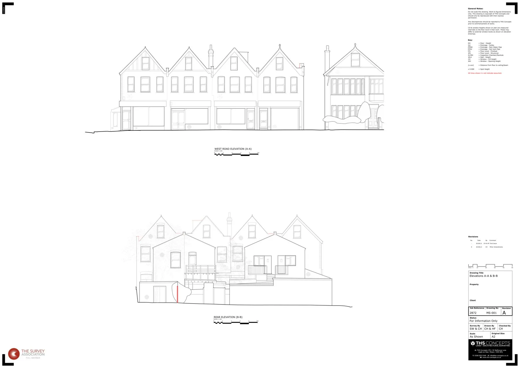
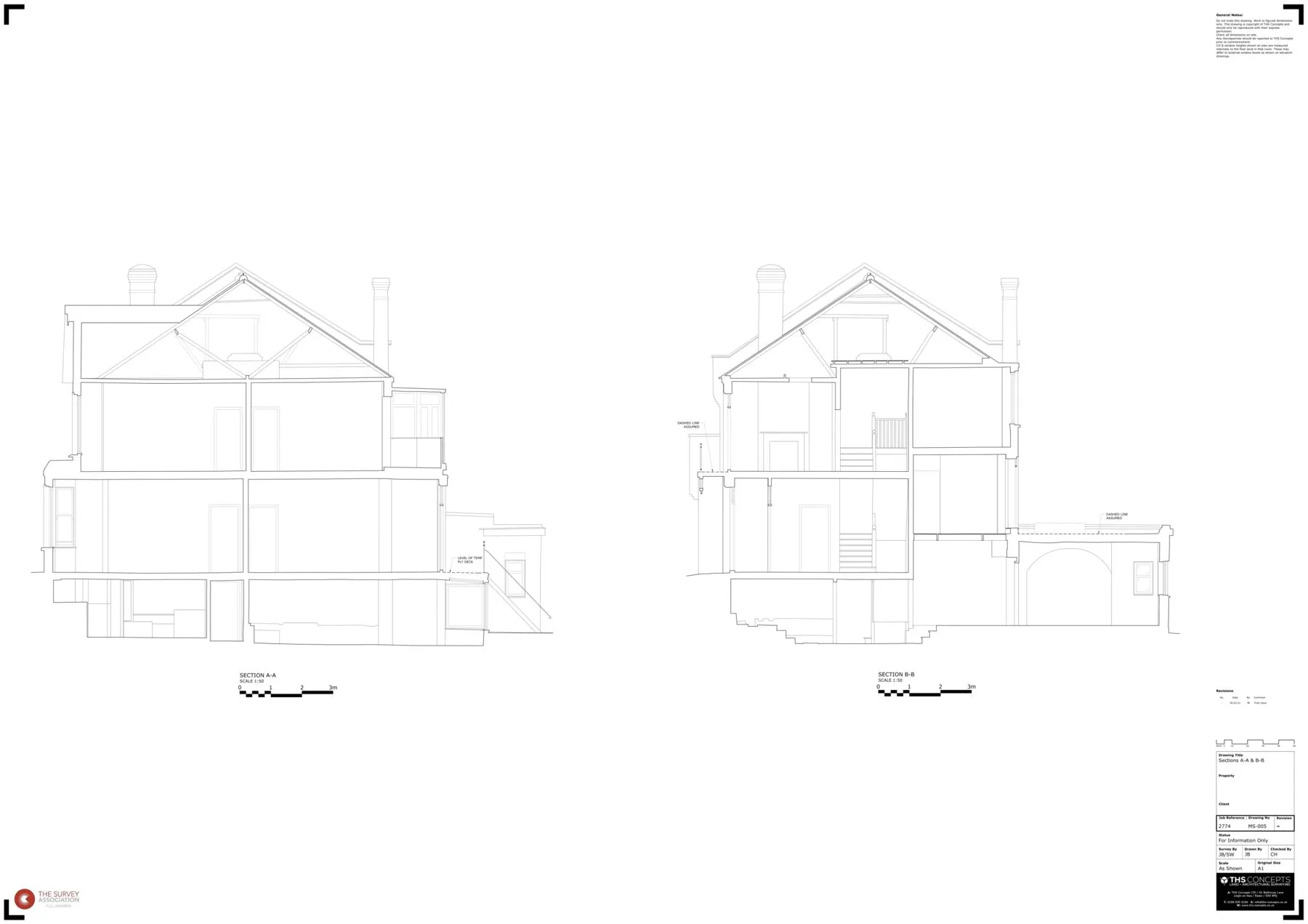
External and internal elevations, sections and roof plans of existing buildings, drawn from laser scan data so every opening, cornice and level is in the right place.
What elevation surveys show
Elevations record the faces of a building: openings, cills, heads, string courses, materials and roof lines, with levels on each storey. Sections cut through the building to show floor zones, ceiling heights, stairs and roof structure. Together with floor plans, they give the design team a complete existing record.
Laser scanned, not estimated
Measuring a three-storey facade with tapes and a laser measure means estimating what you cannot reach. Laser scanning captures every visible surface from the ground in minutes, so the drawn elevation matches the building, including the details that make listed and period buildings difficult.
Roofs and upper storeys
Elevations and roof plans are captured with 3D laser scanners or drones. Roof slopes and rear elevations hidden from the street are flown and merged with the ground scan, so nothing is guessed.
How it works
Scope
Agree which elevations and section lines you need and the level of detail.
Survey
Facades, interiors and roofs are captured with 3D laser scanners or drones, depending on the building.
Draft and check
Elevations and sections are drafted from the point cloud and checked before issue.
Who we work with
Architects
Elevations for planning drawings, facade alterations and loft conversions.
Structural engineers
Sections showing floor zones, roof structure and levels.
Conservation specialists
Detailed records of historic facades and interiors.
What clients say
Read our reviews on Google★★★★★
Having worked with THS for several years now, each project is treated with high professionalism every time. We would highly recommend their team.
★★★★★
I was impressed by THS Concepts topographical survey services' professionalism and accuracy. They were efficient and reasonably priced. I highly recommend them.
★★★★★
We recently approached THS Concepts to carry out a level survey of the screed to the ground floor of a large residential property we were Project Managing. The property was undergoing extensions and refurbishment work. We had a tight timescale to receive the information, and THS Concepts delivered quickly and efficiently to meet our deadline. This is the second time we have used them and would highly recommend.
Elevation surveys: common questions
How do you survey high facades and roofs?
Facades are laser scanned from the ground, which captures detail several storeys up. For roofs and upper elevations hidden from the street, we add drone capture.
Where should section lines go?
Usually through the stair, the main roof and any change in floor level. Your architect can mark them on the plan, or we will suggest positions.
Can you include neighbouring buildings?
Yes. Street elevations including adjoining buildings are common for planning applications.
Related services
- 3D laser scanning
Point clouds and BIM models of buildings, plant and structures.
- Drone surveys
Aerial LiDAR, mapping and roof inspections.
Tell us about your site
Send a location, a rough brief and your deadline. We reply with a fixed quote within 24 hours.