
Topographical surveys in London
Topographical surveys for architects, engineers and developers across all 32 London boroughs and the City. Layered CAD drawings tied to the Ordnance Survey grid, usually delivered 5 to 10 working days after the site visit.
- TSA member since 2013
- Fixed quote within 24 hours
- £1m PI and £5m PL insurance
Land surveys for London’s tight sites
Space in London is tight, so the margin for error in a design is small. A topographical survey gives your design team the exact position and level of everything on site before work starts: boundary walls, buildings, levels, trees, kerbs, drainage covers and visible services, plus the neighbouring features that so often constrain a London scheme.
We tie every survey to the Ordnance Survey grid (OSGB36 for position, OSTN15 for height), so the drawing drops into your model at the right coordinates and the right level. Control stations are left on site, ready for future setting out.
What you receive
- Scaled DWG drawing, layered and colour-coded, with a matching PDF
- Spot levels and contours across the site
- Drainage covers, with invert levels on request
- Full site photographs for design reference
- Drawings 5 to 10 working days after the site visit
Need more than levels and features? We can add utility tracing, 3D laser scanning of the buildings or measured building surveys in the same visit.
How we work in London
We travel in from Leigh-on-Sea and plan each visit around parking, access and any working-hour restrictions, so the survey happens on the day we booked. You speak directly to the surveyor who measured your site if you have questions about the drawing.
Our work in London
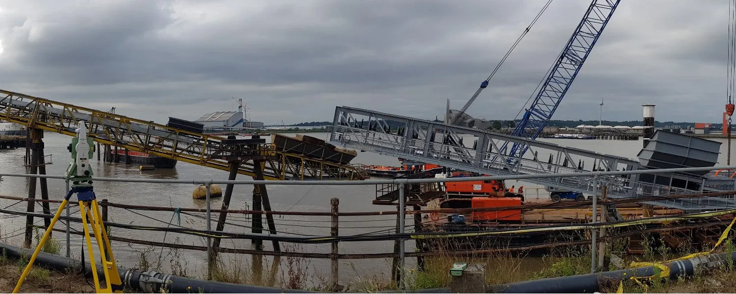
Dagenham, London
Riverside aggregates wharf, Dagenham
Piling setting out, Volume surveys, Remote monitoring and alerts
Wembley Stadium
Monitoring structural movement in the stadium roof.
Whitehall
Survey work for the comprehensive refurbishment of a government office building.
Savoy Pier, Embankment
Surveys for the replacement of the existing pier with a new design.
Barbican Underground Station
Survey work supporting safety-critical platform upgrades.
London City Airport
Survey support for concrete structure testing on the runway apron.
More from THS Concepts in London
Or see everything we do: topographical surveys, all services.
What clients say
Read our reviews on Google★★★★★
I was impressed by THS Concepts topographical survey services' professionalism and accuracy. They were efficient and reasonably priced. I highly recommend them.
★★★★★
We recently approached THS Concepts to carry out a level survey of the screed to the ground floor of a large residential property we were Project Managing. The property was undergoing extensions and refurbishment work. We had a tight timescale to receive the information, and THS Concepts delivered quickly and efficiently to meet our deadline. This is the second time we have used them and would highly recommend.
★★★★★
Having worked with THS for several years now, each project is treated with high professionalism every time. We would highly recommend their team.
Topographical surveys in London: common questions
Do you have a London office?
No. Our office is in Leigh-on-Sea, Essex, 45 minutes by train from central London and 25 minutes from the M25. Most of our work is in London and the South East.
Can you survey busy London streets and tight sites?
Yes. We regularly survey terraced gardens, shared accesses, basements and sites next to live roads. Where we need to work in the carriageway or on a shared access, tell us at quote stage and we will plan the visit around it.
How much does a topographical survey cost in London?
A single residential plot usually costs £750 to £1,500 plus VAT. Larger and commercial sites are priced individually. See our topographical survey cost guide, or send us the address for a fixed price.
Will my survey work with the local planning authority's requirements?
Our drawings are tied to the Ordnance Survey grid and datum, which is what London planning authorities and design teams expect. If your architect or engineer has a specification, send it with your enquiry and we will survey to it.
Need topographical surveys in London?
Send a location, a rough brief and your deadline. We reply with a fixed quote within 24 hours.