
Point cloud surveys
A registered, millimetre-accurate point cloud of your building or site, delivered in the format your team uses so they can measure, model and design directly from it.
When a point cloud is enough
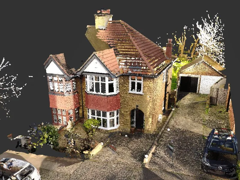
Many design teams have the skills to model or draft in-house and just need accurate data to work from. A point cloud survey gives them exactly that: the whole building as millimetre-accurate 3D data, without paying for drawings or a model they would rather produce themselves.
Accuracy and registration
We scan with FARO scanners, from the S70 static scanner, stated at ±2mm at 25m, to the Orbis mobile scanner for large areas. Scans are registered in FARO Scene, with registration error typically within 3mm across a building.
Formats for every workflow
RCP and RCS for Revit and Navisworks, E57 for almost anything else, FLS for FARO Scene and PTS or PTX for older CAD software. If you later need drawings or a model, we can produce them from the same cloud. See scan to BIM.
How it works
Brief
Tell us the area, the format your team uses and whether the cloud needs to be on a site grid.
Scan
FARO scanners capture every space in the brief at the right resolution.
Register and deliver
Scans are registered, checked and delivered by secure link in your chosen format.
What it costs
Price depends on the size of the building and the number of scan positions.
| Typical job | Guide price |
|---|---|
| Point cloud only | From £600 |
Prices exclude VAT.
Who we work with
In-house BIM and CAD teams
A cloud to model or draft from with your own team and standards.
Structural and MEP engineers
Measured geometry to check clearances, routes and structure.
Main contractors
An existing-conditions record before work starts.
What clients say
Read our reviews on Google★★★★★
Having worked with THS for several years now, each project is treated with high professionalism every time. We would highly recommend their team.
★★★★★
I was impressed by THS Concepts topographical survey services' professionalism and accuracy. They were efficient and reasonably priced. I highly recommend them.
★★★★★
We recently approached THS Concepts to carry out a level survey of the screed to the ground floor of a large residential property we were Project Managing. The property was undergoing extensions and refurbishment work. We had a tight timescale to receive the information, and THS Concepts delivered quickly and efficiently to meet our deadline. This is the second time we have used them and would highly recommend.
Point cloud surveys: common questions
What is a registered point cloud?
Each scan position produces its own cloud. Registration aligns them all into one coordinate system, so the whole building is a single, measurable 3D dataset. Our guide What is a point cloud? explains more.
How do I open the files?
Revit, AutoCAD, Navisworks and most BIM tools read RCP or E57. Free viewers are also available. See how to open point cloud files.
How big are the files?
Anything from a few gigabytes for a house to hundreds for a large building. We can decimate or split the cloud by floor so it runs smoothly in your software.
Related services
- Measured building surveys
Floor plans, elevations and sections of existing buildings.
Tell us about your site
Send a location, a rough brief and your deadline. We reply with a fixed quote within 24 hours.