Dunton Road, Basildon, Essex
Dunton Road, Basildon
A 35 hectare development site captured by drone LiDAR, with ground control, for a land developer.
Drone LiDAR surveys, Topographical surveys

Services
Layered, colour-coded CAD drawings tied to the Ordnance Survey grid, measured by surveyors who answer their own phones. Topographical surveys start from £600 + VAT, and most drawings arrive within 10 working days of the site visit.
Full member of The Survey Association, the UK trade body for survey companies.The Survey Association
Quotes in 24 hours
Fixed price, confirmed timescales, no surprises on the invoice.Fixed price
Since 2013
Over 4,000 surveys, from home extensions to nuclear power stations.Over 4,000 surveys
Fully insured
£1m professional indemnity and £5m public liability cover.£1m PI, £5m PL
A topographical survey, land survey, topo survey and site survey are the same piece of work. A land surveyor visits your site, measures the position and level of everything on it, and produces a scaled drawing your team can design from.
The name changes depending on who is asking. Architects and engineers specify a topographical survey. Planning consultants and homeowners say land survey. Contractors say site survey. If your drawing schedule or planning officer has asked for any of them, this is the service you need. For a fuller explanation of what the drawing shows and how to read it, see our guide What is a topographical survey?
Your survey arrives as a scaled CAD drawing (.dwg) with a matching PDF, tied to the Ordnance Survey grid: OSGB36 for position and OSTN15 for height. It drops into your model at the right coordinates and the right level, with no re-basing and no chasing us for a datum.
The drawing shows boundaries, levels and contours, buildings, hard and soft landscaping, trees, kerbs, drainage covers and the services visible at ground level. Every drawing is layered to a consistent standard and checked before it leaves us.
Existing structures, drainage runs, trees and level changes recorded at the start show up at design stage, not as a change order on site. Because the control is tied to the OS grid and left on site, the survey still works when the next consultant joins the project or the contractor arrives to set out.
The right level of detail depends on what the drawing is for. A 1:200 survey for a house extension needs a different density of levels and features from a 1:500 survey of a development site or a highways scheme. Tell us what the survey is for and we will set the detail to suit, or work to your own specification or office template where you have one. The survey notes on every drawing state the datum, the control and what was captured, so the next consultant knows exactly what they are working from.
A topographical survey records the physical features on site as they stand, including the walls, fences and hedges along its edges. It does not decide where a legal boundary lies. It does not show services below ground unless a PAS 128 utility survey is added, and internal layouts and elevations of buildings belong to a measured building survey.
Most planning applications need more than the site plan. In the same visit, on the same survey control, we can add street scene elevations of your building and its neighbours, measured roof plans, an underground utility survey and aerial imagery from a drone survey. Every drawing then lines up with the others.
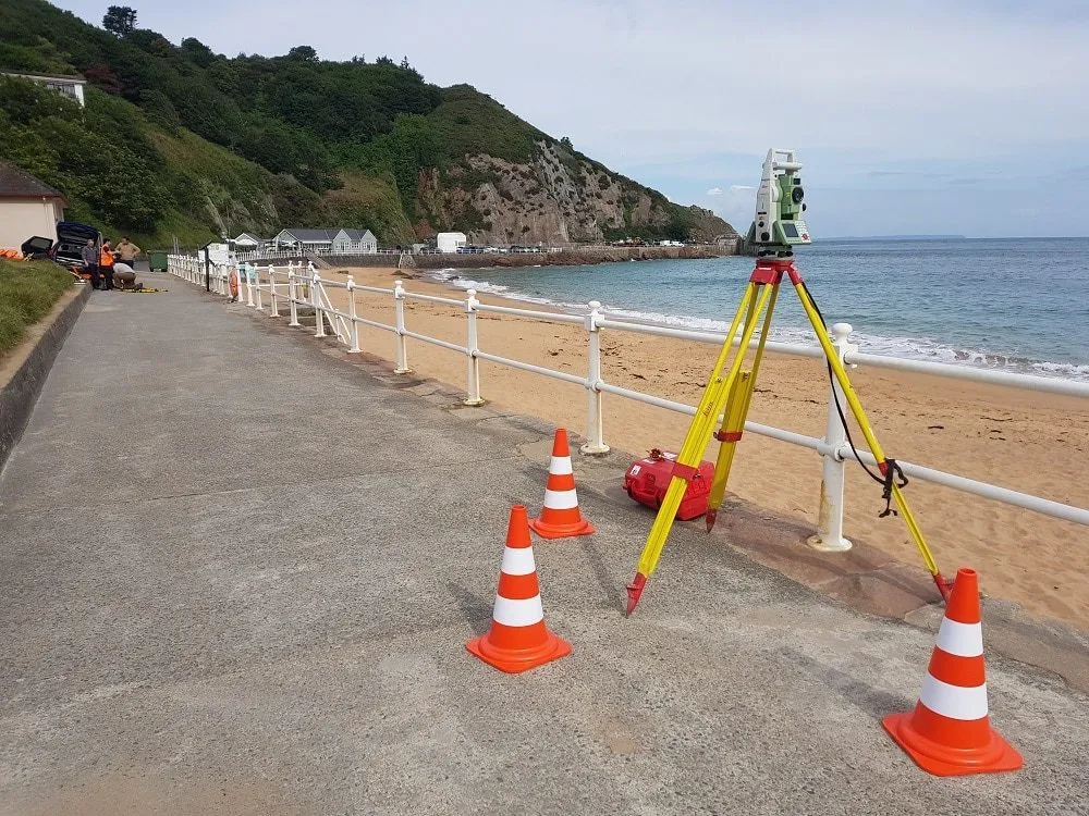
Most of our topographical surveys are in London, Essex, Kent, Hertfordshire and the rest of the South East. We travel nationwide for framework clients and one-off projects, and have surveyed tidal beaches in Jersey, a live port in Liberia and solar farms mid-construction. If access is the problem, tell us. It usually is not one.
The existing site information your planning drawings depend on: levels, boundaries, trees, access and neighbouring buildings, tied to the OS grid and drawn ready for your architect to design over.
Spot heights, floor levels and falls measured to OS datum or a site datum, for drainage design, slab and screed checks, flood risk assessments and site grading.
Gas, electric, water, telecoms and drainage traced with ground-penetrating radar and electromagnetic location, and mapped to the OS grid before you dig. Surveyed to PAS 128 Quality Level B as standard.
A focused topographical survey of your site showing the levels of the land, with floor and threshold levels, all to Ordnance Survey datum. Exactly what a flood risk assessment needs, without paying for a full survey.
Repeatable cut and fill, stockpile and excavation volumes from GNSS RTK or drone surveys, reported by material where needed, for earthworks design, valuations and contractor payments.
Send a location plan with the survey area marked. We reply with a fixed price, a survey date and a date for your drawings.
We capture the site with GNSS RTK receivers and total stations, to your specification or our own standard, and photograph it as we go.
We draft the survey in CAD, layered to our standard or to your office template, and check every drawing before it leaves us.
You receive .dwg and PDF files at the right coordinates and levels. Questions go straight to the surveyor who measured your site.
Topographical surveys start from £600 + VAT. The price then depends on the size of the area, the level of detail and how easily we can get around the site. Send us the address and we will give you a fixed price.
| Typical job | Guide price |
|---|---|
| Single residential plot or extension | £600 to £1,500 |
| Larger residential or small commercial | £1,500 to £2,500 |
| Commercial or infrastructure site | From £2,500 |
Prices exclude VAT and assume normal working hours and unrestricted access.
A base drawing to design over, at the right coordinates and the right levels.
Levels, gradients, drainage covers and invert levels for drainage and highways design.
The survey your planning application needs, before you commit to design fees.
A survey of your plot or garden for an extension, basement or new build. Yes, we survey single houses.
A site survey for setting out, earthworks volumes and progress records.
Dunton Road, Basildon, Essex
A 35 hectare development site captured by drone LiDAR, with ground control, for a land developer.
Drone LiDAR surveys, Topographical surveys
Foulness Island, Essex
Land, dyke and water levels across a working MOD island, captured for a civil engineer designing a new drainage scheme.
Hydrographic surveys, Topographical surveys, Drone surveys
Leigh-on-Sea, Essex
A combined 3D laser scan and topographical survey of a working school, delivered for an architect preparing a planning application.
Planning application surveys, 3D laser scanning
We carry out topographical surveys across the UK from our office in Leigh-on-Sea, Essex. Local pages:
★★★★★
I was impressed by THS Concepts topographical survey services' professionalism and accuracy. They were efficient and reasonably priced. I highly recommend them.
★★★★★
We recently approached THS Concepts to carry out a level survey of the screed to the ground floor of a large residential property we were Project Managing. The property was undergoing extensions and refurbishment work. We had a tight timescale to receive the information, and THS Concepts delivered quickly and efficiently to meet our deadline. This is the second time we have used them and would highly recommend.
★★★★★
We have used THS Concepts for multiple surveys from topographic to drone photogrametry, they are professional and prompt and deliver exactly what is requested. Highly recommended.
Yes. In the UK the terms are used interchangeably, along with site survey and topo survey. All of them describe a measured, scaled drawing of a site's features and levels. Architects and engineers usually write topographical survey in their specifications.
Usually, yes, for anything beyond a minor extension. Our page on topographical surveys for planning applications explains what planners and architects need.
Not by default. A topographical survey records what is visible at ground level, including covers, gullies and service markers. If you need the runs between covers, we can lift covers and measure invert levels, or carry out a full underground utility survey. Tell us at quote stage.
GNSS RTK receivers and total stations on site, and BricsCAD for drawing production. For complex or hard-to-reach sites we add 3D laser scanning and drone photogrammetry.
A topographical survey records the land: levels, boundaries, trees, drainage and hard surfaces. A measured building survey records the building: floor plans, elevations and sections. Many projects need both.
Floor plans, elevations and sections of existing buildings.
Gridlines, foundations, piles and roads set out on site.
Aerial LiDAR, mapping and roof inspections.
Send a location, a rough brief and your deadline. We reply with a fixed quote within 24 hours.