Sale – 10% Off All Services – Get Your Quote Today – Expires Soon.
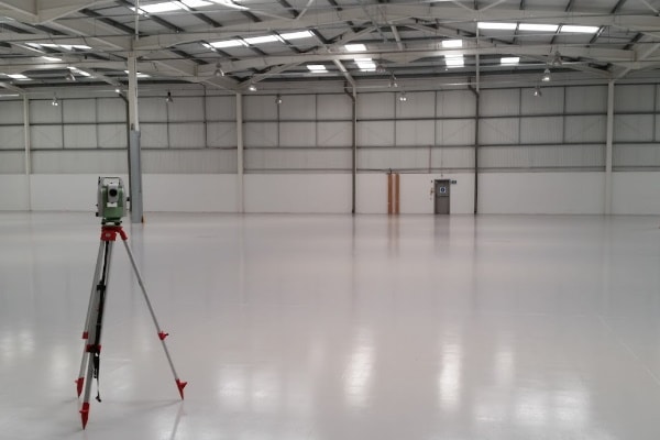
Utilising precision dumpy levels and total stations, we accurately carry out precise level surveys for building contractors focusing on flat roofs, concrete slabs, drainage runs, and more.
Are you aware of your specific needs and/or wish to include files? Please complete our detailed form here.
THS Concepts are an accredited member of The Survey Association body.
We operate nationwide across the United Kingdom.
THS Concepts was formed over 10 years ago in 2013.
£1 million in liability cover, employers' and public liability insurance.
We take great pride in our exceptional 5-star ratings on both Google and Trustpilot
Operating across London and the South East, our experienced team use the latest Leica equipment, from total stations to 3D scanners. We ensure your level survey requirements are undertaken quickly and cost effectively.
We typically work with the principal contractors on site who are looking to verify a subcontractor’s work, for example verifying a recently-poured concrete slab.
These are some typical project types we offer our level survey service on:
• Verification surveys
• Concrete slab pours
• Roofing
• Drainage

Prior to undertaking a survey of a property, we discuss with the clients their exact project requirements, as each project usually requires a varying level of detail in certain areas.
Our survey service will pick up levels at set grid intervals depending on your requirements. An example grid size could be 2.5 x 2.5 metres.
We use the industry-leading software Autocad by Autodesk to produce the drawings you require.
Over the years, we have refined our drawing package to ensure our clients can utilise, manipulate and get on with their projects as quickly as possible.
Key features of the drawings we provide are:
To make life easier for those without CAD we issue scaled PDF copies which can be printed at A4 / A3 and easily marked up.
We take the safety of our staff and the public very seriously. Prior to a job, we provide our surveyors and clients with job specific method statement and risk assessment (RAMS) documents.
On-site our surveyors have the relevant personal protective equipment (PPE) for the work required. In specific cases, such as working near water, they will have other equipment such as life jackets.
We ensure you are 100% happy with the topographical drawings we have provided. If there are any issues, then we are more than happy to rectify these free of charge. This may include re-visiting the site or addressing something in the drawings.
In the event that you are still not satisfied with our services, we offer a 100% money back guarantee.
The cost of a level survey depends on the extent, size and specification of the area that needs surveying.
We can quote the works based on a day rate if need be, however, we prefer to give a fixed price as this is advantageous for both you and us.
If you are looking for a quote then get in touch to discuss your project. We will then send you a formal quote for the required works!
THS Concepts operate nationally and internationally, we have worked from Edinburgh in Scotland to Liberia in West Africa.
On a day to day basis, we typically undertake our surveys in the South East of the UK. This includes London, Essex, Kent and Sussex.
We know how important it is to get drawings and information returned as quickly as possible.
Our typical lead-in times are 5 to 10 days with level survey information returned as quickly as 24 hours after the survey has been completed.
Other services may be available in addition to our measured survey service to assist you with your project. Please see below:
We can survey the land around your building, picking up key bits of information such as land heights, tree locations, outbuildings, changes in surface, drainage, and more.
See our topographical survey service
By default, we utilise 3D scanners on our measured survey projects to produce accurate 3D point cloud files. These are then translated into floor plans, elevations and sections etc.
See our utility scanning service.
Providing a setting out engineer to your site, we can set out items such as foundations, brickwork, steel and more.
See our Setting Out Surveys
92 Bellhouse Lane, Leigh-on-Sea, Southend-On-Sea, Essex, SS9 4PQ
76 Quill Street, Finsbury Park, London, N4 2AD
THS Concepts has a passionate team of surveyors and CAD draughtsman delivering detailed, thorough and accurate surveys and CAD drawings. We are far more than just a land and building surveying company.
Terms & Conditions | XML Sitemap | Copyright 2022 – THS Concepts LTD